Indigenous communities fight for the right to their own land
By Ariana Bennett
LA GUAVITA, Guna Yala— In three days, Anel Perez will see his family again. He sits leaning forward with elbows on knees on a wooden stool outside the La Guavita outpost on the southern border of Panama’s Chepo province and Guna Yala, an indigenous territory on the northeastern coast of Panama.
Perez, 62, has been contracted for three months to the outpost – which is an hour’s walk from the ridge forming the Continental Divide – but he has long been familiar with La Guavita. In the 1980s, he remembers when work began to demarcate the southern border of the comarca, where large metal poles were staked 3 feet deep into the bright red soil along approximately 60 miles of the comarca’s border. He started working in the area in 1994, two years before the outpost was built.
“To avoid [encroachments], that’s why we came here,” Perez said. He began patrolling the trails surrounding the outpost in 2018 and has recently returned after the pandemic halted the rangers’ operations. On Sunday, he finishes his 15-day assignment and will spend 10 days off with family on Garti Sugdub, his island community.
Guna Yala is Panama’s first comarca, a local or regional administrative territorial division governed semi-autonomously by indigenous peoples. There are six comarcas in Panama: Guna Yala, Emberá-Wounaan, Guna Madungandi, Ngäbe-Buglé, Guna Wargandí and Naso Tjër Di. Guna Yala was recognized in 1938 and declared an indigenous reserve in 1957. There are 51 communities living in the comarca, 40 on the islands and 11 on the mainland, which stretches 232 miles along the northeastern Caribbean coast of Panama.
Despite Guna Yala’s official designation dating back almost 85 years, boundaries remain uncertain. Campesinos, or rural farmers, encroached upon the land, cutting trees for pastures. To prevent further invasion and ensure long-term border protection, eight young Gunas, aged 20-24, conducted research and fieldwork to map the border of Guna Yala in the 1980s, evicting more than 80 families totaling 500 people within four years.
Today, the border of the comarca runs along the Continental Divide, a ridge where rivers falling to the north flow to the Caribbean Sea and rivers to the south empty into the Pacific Ocean. The border is marked with thick red metal poles every .6 of a mile. Seeking further protection, a boundary commission sought to declare the comarca a protected area, which required additional documentation. After three years of attempts and technical training support from international organizations, the Guna General Congress approved the protected area of Nargana in 1987. It was recognized by the Panamanian government in 1994.
As of 2018, the last year for which data are available, there were 24 similar, pending indigenous land claims. But like the long walk to La Guavita, the path toward official recognition is long and arduous for these territories: A litany of legislation outlines the requirements for land titling and encroachments are common, either from farmers or illegal hunters or miners. Which is why the work of the guards at the outpost is so critical, Perez said.
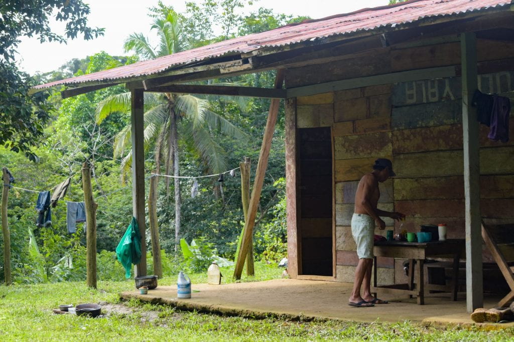
Made of wooden boards save for a corrugated metal roof, the one-room outpost he’s based in has three low wooden beds and is littered with the belongings of the three rangers who patrol these borders during the days.
Another ranger there on this early June day, Geronicio Camargo, 45, also returns to live with his family—two sons and two daughters in the community of Solidad Mandinga—when he’s not on duty. “For [me], it is important,” he said through a translator, “because [I] feel [I] am protecting this land for [my] sons.” For this reason, Camargo comes every time duty calls.
Old land, new laws
Today, there are seven indigenous peoples recognized by the government in Panama—Gunadule, Emberá, Wounaan, Ngäbe, Buglé, Naso Tjër Di and Bri Bri. Anywhere from 10% to 15% of Panama’s population self-identify as indigenous. Article 127 of Panama’s national constitution guarantees the reservation of necessary lands and collective ownership to indigenous communities. Comarcas remained the only legal protection for ancestral lands until 2008, when Law 72 established “tierras colectivas,” or titled collective lands. Executive Decree 223, passed in 2010, delineated the titling requirements under the National Authority for Land Administration (ANATI). Then in 2015, the National Coordinating Committee of Indigenous Peoples (COONAPIP) began to train youth in community forest monitoring in tandem with Rainforest Foundation US and the Food and Agriculture Organization (FAO), both based outside the country. The training involves the use of drones for both monitoring and mapping.
These requirements consist of three main parts, according to Heraclio Lopez, director of the Instituto Patrimonio Cultural del Pueblo Guna, beginning with a management plan. Then, a technical study, first required by resolution DM-0612-2019, must be completed by the vice-ministry of Indigenous Affairs, which proves ancestral occupation of collective lands begun before the creation of the inhabited protected areas. Third, the community requesting the title must be named in the national census of Panama.
Claus Kjaerby, chief operating officer at Geoveristy, an environmental education organization, identified the need for a map of the proposed territory and description of neighboring land owners as key to the process. The claim, once published, allows oppositions to be resolved.
“There are a lot of rights that are connected to territorial rights,” Kjaerby said. Although it differs by individual circumstance, indigenous communities may gain sovereignty over natural resources, self-governance and legal protection. Geoversity is intimately involved in a land titling claim of the Emberá people living in Chagres National Park. Geoversity also hosts students from University of Redlands who participate in a mapping program aimed at watershed boundaries, trails and habitats.
Regardless of the process now in place, it is common for the pace of approval to change from administration to administration, said Enrique Arias, one of the original topographers of the Guna Yala comarca. For example, in the event of illegal hunting or deforestation, complainants are to contact the Ministry of the Environment, but the ministry lacks the necessary staff to respond. “Remember we are talking about politicians, so right now they’re not thinking about the environmental world,” Arias said.
The key is to register land complaints with official proof. “These communities began to make these reports with drones, with GPS, with phones that have GPS and then began to indicate to the central government, to the local government, ‘Look, these are the reports, here is this illegality happening, illegal deforestation within the territory,’” said Carlos Doviaza, project manager for GeoIndigena, an organization dedicated to the technical services needed for collective and indigenous land mapping. “This was a strength to measure, to quantify, how many hectares of forest were cut in such and such a place.”
Technologies including GPS, satellite and traditional compass, can solve discrepancies between communities. Most recently, Doviaza and a team of fellow technicians resolved a conflict between the bordering communities of Alto Tuira, an Emberá community, and Tagarkunyala, a Guna community, both located in the Darien province. The mapping process took about a week.
Where the rivers are born
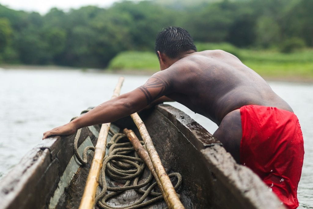
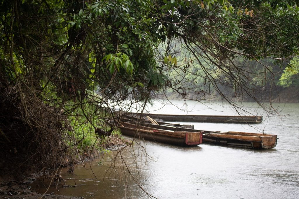
The Río Pequení is shallow, but its currents run strong. Wooden piraguas, dugout canoes hand-powered with long, handcrafted poles, control transport to and from the community of Emberá Purú, buried in the heart of Chagres National Park. It is one of eight Emberá communities seeking a title for the land. While 85% of the newest comarca, Naso Tjër-Di, established in 2019, overlapped with La Amistad International Park in eastern Panama, the Ẽjuä So, totaling 218,332.43 acres, is the first land claim by indigenous peoples to overlap entirely with protected area.
In the 1990s, Panama began establishing many protected areas, said Kjaerby. “They ended up being established exactly where the indigenous territories are, and for some good reason. There was still something to protect,” he added. “They have been protecting it forever because it is their traditional territory, the best guardians of the forest.”
In Emberá Purú, red flowers dot the landscape as the surrounding mountains mimic the uneven slope of the roofs. Huts, with floors made of roots from the “walking palm” tree, are open to the air and rest high on stilts to protect from animals and severe flooding. In the June rainy season, afternoon rain is common. Bare footprints crisscross the ground on the trails between houses. Children and adults alike are dressed in brightly colored patterned cloth. Yellows, purples and reds flash against green as children play and adults attend to daily life.
Lisett Chami, 32, left Emberá Purú to study in Panama City. With a green patterned cloth wrapped around her waist, she sits with one foot tucked behind her ankle. Her body is covered in tattoos drawn from jagua fruit ink. “In Panama, you had a lot of things to breathe. Here, it’s free to breathe,” she said. “It’s different how you live here.”
Light laughs bubble from her lips, colored a subtle red, as she clasps her hands in her lap, wrists adorned with silver cuffs.
“You have time to go swim in the river,” she said. “You’re free.”
This territory is emblematic, according to Lopez. The land lies within the Panama Canal watershed and is vital to maintaining the proper water levels in the three locks, through which roughly 6 percent of global trade travels yearly.
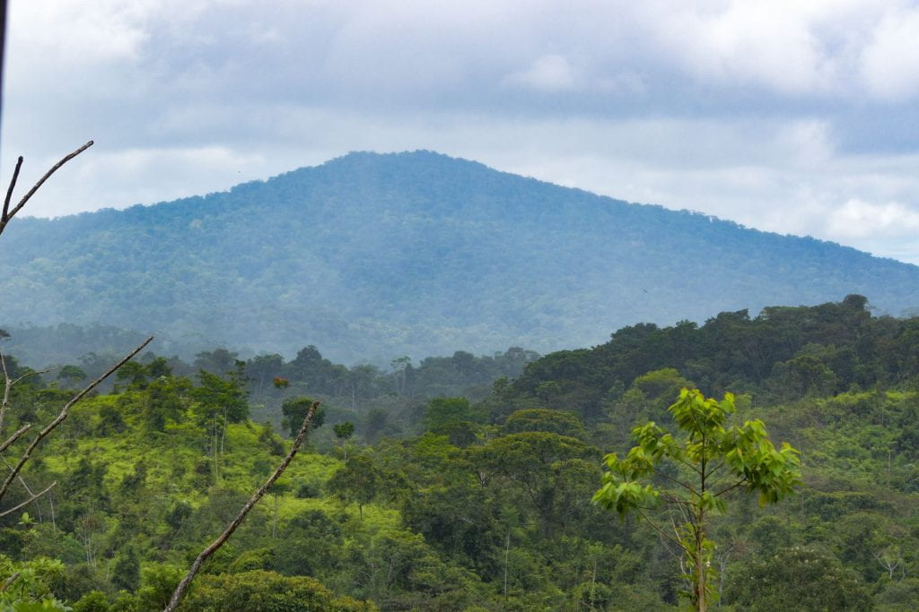
Spiritually, the Emberá are the guardians of water, but they are the de facto caretakers as well. “The one that takes care of the most reservoirs and springs of the water are the Emberá,” Lopez explained. In the northwest of the proposed territory lies Cerro Bruja, the source of seven rivers in the area, including the Chagres, and a sacred site for the Emberá people.
Negotiators have been in titling negotiations with the Panama Canal Authority for the past two years. “Here we have the Panama Canal, that the water they are using goes to the canal, and it is also being used by Panama City. That is the obstacle that they see that, if we title the land, ‘they do what they want,’” Antonito Zarco, one of two regional caciques, said through a translator. Caciques are regional indigenous leaders tasked with carrying out the collective titling procedure before ANATI on behalf of the community.
The titling process began in 2000, but was slow going for 5 years as the Emberá developed their leadership system. Slow progress since then is the result of changing requirements. “We are seeing that each government that comes in brings in different processes, different conditions…so that’s why they take so long,” Zarco explained.
According to article 13 of Law 72, if lands awaiting titling are a part of a nationally protected area, the Ministry of Environment is to develop sustainable-use plans for natural resources and community development in tandem with traditional authorities. Chagres National Park was established in 1984; it is documented, according to Lopez, that the Emberá and Wounaan people have been living in the watershed since at least 1920. That is one of two arguments the Emberá are placing before the Ministry of Environment. The other is that most of the forest found in Panama is directly related to where indigenous peoples are, Lopez said.
In 1972, a program named Assemiento Campesinos aimed to provide land for those left without it in the provinces of Veragua and Los Santos. Today, there is cooperation between the Emberá living in Chagres National Park and 24 campesinos communities of 40,000 people surrounding their land. “With the arrival of tourism, we no longer devastate, we don’t cut, we don’t do it anymore. Right now we are taking care of it as they say,” Zarco said. The territory, full of primary forest, is also an important resource for carbon sequestration.
With the support of Geoversity, the eight communities have mapped the territory and collected their management plan and technical study. The next step is to hire a lawyer to aid in the titling process. Discussions are ongoing with the bordering campesino communities, and the future of the land as an official protected area, if titled, is unsure, according to Zarco. He believes that the Emberá could manage the park as the Guna do in Nargana National Park.
Arias, the topographer, sees the La Guavita outpost as past its heyday, but he wonders if it could someday serve as a research station. That is, if the General Congress continues to maintain the post. Eliberio Santizo, 23, is the youngest volunteer on staff. Behind a shy adolescent smile, he speaks of a supportive family and the wildlife he encounters as he walks the patchwork of trails leading up to the border.
“I didn’t know where the border of Guna Yala was, and now I know,” he said. Young people, for Arias, are the new guardians of the forest. Their task is to monitor and to educate. Yet, he worries that as the older generation fades, nothing will be the same. “Who is in charge now has never been concerned about this fight,” he said. The younger generation has not lived the same struggle for the land.
Arias’ generation saw their land, and its title, as their first priority. “Who’s there now? You have to be on top of them all the time,” he said. “What do I see? [People] are forgetting little by little.”